


The Azores are full of hiking superlatives, from crater rims and laurel forests to raw volcanic slopes and ocean cliffs. After several trips that took me across São Miguel, Pico, Faial and Flores, a handful of trails stood out strongly enough that I would walk them again tomorrow. This article focuses only on routes I have personally hiked, cross checked with the official Azores Trails network, and compares them regionally so you can choose the style of hike that actually fits how you like to walk.
How the Official Azores Trail System Works
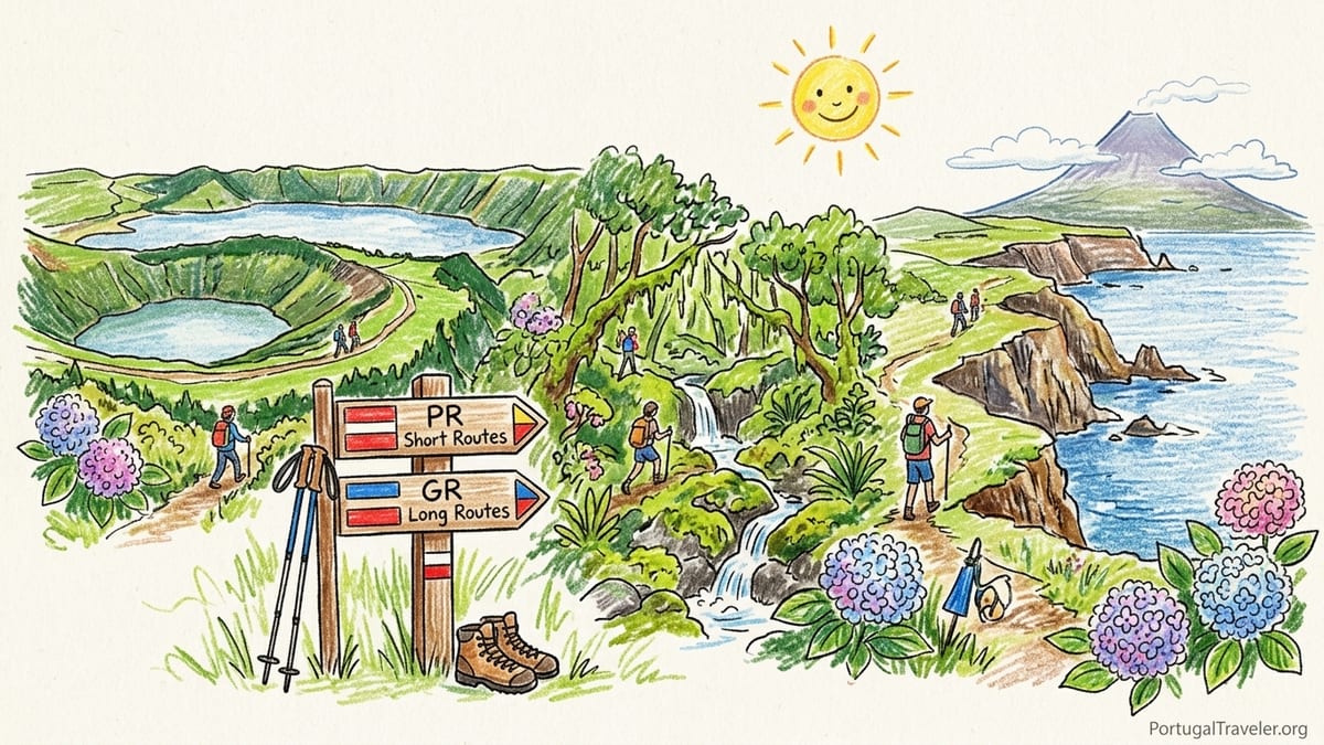
The nine Azores islands share a unified, classified trail network managed by the regional government. Routes are listed on the official Azores Trails platform under codes such as PR (short routes) and GR (long routes), with difficulty graded as Easy, Medium or Hard. Distances, estimated times and elevation profiles are all published there, and the on-the-ground waymarking uses colored stripes on wooden posts and rocks. In practice, I have generally found the distances accurate, but the time estimates can be conservative if you hike steadily and do not stop at every viewpoint.
Safety guidance from Azores Trails emphasizes checking the weather forecast, choosing routes suited to your fitness, carrying adequate clothing and food, and remembering that mobile phone coverage can be intermittent away from villages. The advice is not theoretical. On Pico and Faial in particular, I have seen fog and rain an hour after clear blue skies, and there are sections where my Portuguese SIM dropped to emergency calls only. The guidance also highlights appropriate footwear, and this is another area where experience matters more than marketing. Lightweight trail runners are fine on some forest and coastal paths in dry weather, but many volcanic and highland routes become slick with mud and loose rock after rain, where a boot with better grip and ankle support feels far safer.
Across the network, the trail types fall loosely into five categories: crater or caldera hikes, coastal paths, forest and levada style routes, explicitly volcanic landscapes and highland traverses. Instead of covering every island in turn, I am going to group the routes I would happily repeat by these types, and explain where the official difficulty felt accurate and where it did not. Dedicated island-by-island hiking guides can come later; this piece is about picking the right flavor of Azores hiking for you.
One final practical note before we step onto the dirt: conditions change. Official listings are updated with temporary closures and reroutes after landslides, forestry work or storm damage. On São Miguel alone I have had to detour around closed sections near Lagoa do Fogo and Salto do Prego after heavy rain. Before you lace up, check the current status on Azores Trails or at a local tourist office, and be prepared to adapt on the day.
Crater & Caldera Trails: Walking the Rims and Dropping to the Lakes
If you imagine Azores hiking as narrow paths along dramatic crater rims above blue and green lakes, you are thinking of three specific routes I would gladly repeat: the Sete Cidades caldera rim on São Miguel, the descent to Lagoa do Fogo, and the Caldeira loop on Faial. All are officially graded Medium, and all three felt slightly easier than their reputations provided you pick a clear, settled weather window.
The Sete Cidades rim section I favor starts near Mata do Canário on São Miguel and follows part of the PR4 SMI route towards Vista do Rei. Official figures list the full route as roughly 11 to 12 kilometers with a time estimate of about 3 to 4 hours and Medium difficulty. In practice, walking at a steady but unspectacular pace with photography stops, I have covered the rim portion in just over 3 hours. Elevation gain is moderate, with some short climbs but nothing sustained. Underfoot it is mostly compact dirt and gravel double track, with muddy patches after rain. Exposure is more about wind than drop-offs; while you are technically on a crater rim, the track is broad enough that vertigo is rarely an issue. On a dry, partly cloudy day wearing trail runners, I found the official Medium rating felt slightly cautious. In fog or strong wind, that same track would feel far more serious and I would want a waterproof shell and sturdier shoes.
Lagoa do Fogo, on the south side of São Miguel, is a different style of crater hike, combining a descent to a wild beach on the lake shore with a steady climb back out. The classic official route approaches from the south, running around 11 kilometers with about 500 to 600 meters of total elevation gain and an average time around 4 hours. The trail starts on an old forest track, passes through sections of hydrangeas and native vegetation, and then drops on steeper switchbacks to the shore. The day I last walked it began in full sun with scattered clouds and light wind at the ridge, but the crater filled with mist within an hour. The descent becomes muddy and slick after rain, and several hikers without poles were skidding on the steeper turns. With waterproof mid-cut boots and trekking poles, the mud was manageable. Officially graded Medium, the trail felt like the top end of Medium when wet, and I would treat it as bordering on Hard if you have any knee issues. Mobile phone signal vanished inside the crater. There is no reliable water source on the route, and shade is limited to brief forest stretches, so bring at least 1.5 liters per person in summer.
Faial’s Caldeira, near Cabeço Gordo, is the most complete crater loop I have walked in the Azores. The official Caldeira trail is a circular route of roughly 7 kilometers around the rim, usually listed as Medium with 2.5 to 3 hours of walking. Elevation change is modest in total, but the rim undulates constantly, and the footing alternates between compact dirt, roots and short rocky steps. On my last visit, the park authority had a section of the rim closed after rockfall, so the loop became an out-and-back along the safe portion, still worth it for the panoramic views into the deep green crater and across to Pico on a clear day. Weather is everything here. I have driven to the trailhead twice and found the crater full of cloud with visibility at a few meters, at which point the loop is more a navigation exercise than a viewpoints hike and I turned back. On the successful day, clear skies, a moderate breeze and dry ground made the official Medium rating feel accurate. Trail runners were adequate, though in wet conditions I would prefer boots for the rooty, sloping sections.
Coastal Routes: Cliffs, Fajãs and Atlantic Views
Coastal hikes in the Azores are often tempting on days when crater rims sit in thick cloud. They also tend to be less committing in terms of elevation, though they can still deliver some short, steep climbs between sea level and cliff-top viewpoints. Two coastal routes I have happily repeated are the Agualva coastal trail on Terceira and a section of the long route on Flores linking Ponta Delgada and Fajã Grande.
On Terceira, the Agualva coastal trail, part of the official network, runs for just under 4 kilometers in one direction, with an official time around 2 hours and Medium difficulty. The route undulates along low cliffs, drops to a pebble beach and then climbs back through pasture with Atlantic views almost the entire way. Elevation gain is modest, rarely more than a couple of hundred meters overall, and the path is mostly dirt and rock with some uneven steps. I have walked this on a bright spring morning with light wind and found the official Medium rating conservative; for anyone used to coastal walking, it feels Easy to lower Medium. Mud is a factor after rain, especially near the low-lying sections where water collects. Shade is limited to occasional stretches near small groves, and there are no services or water on the route, so carry what you need. Mobile coverage has been present but patchy, with signal dropping in some coves.
On Flores, several sections of the official Grande Rota connect villages along the dramatic west coast. The segment I keep returning to lies between the viewpoint plateau above Fajã Grande and the high ground above Ponta Delgada. Officially, the full long route is graded Hard, about 47 kilometers total, with an estimated 18 hours of walking broken into stages. I have only day-hiked portions, typically 10 to 15 kilometers at a time with cumulative elevation gains of 500 to 700 meters. The scenery here is some of the richest coastal walking in the archipelago: tall cliffs dropping directly into the ocean, multiple waterfalls threading down green walls, and occasional stone-paved descents into tiny fajãs. Underfoot, expect a mix of old cobbles, dirt and wet grass. After a rainy night, the path can be very slippery, and I have seen hikers turn back from steep cobbled zigzags that felt like wet ice in trail runners. For this coast I prefer a boot with a more aggressive sole, especially if you are carrying a full day pack. Official Hard difficulty feels fair, not because of any technical scramble, but because of the cumulative distance, constant ups and downs and the exposure to Atlantic weather. Wind can be fierce on the headlands, and there are long stretches without shade or water outlets.
Logistically, both routes are easier with car shuttles or taxis. On Terceira, it is straightforward to park near the official trailhead at Agualva, walk the linear route and return the same way. On Flores, I have either arranged a taxi drop at one end or left a car at Fajã Grande and walked a return variant, accepting that I would repeat scenery I was not bored of seeing twice. Coastal villages sometimes have small cafes or minimarkets, but I would not rely on them being open outside peak season or in the late afternoon. As with most Azores coastal paths, mobile signal tends to improve as soon as you gain a little height above sea level.
Forest & Levada Style Walks: Shade, Streams and Mud
For days when the sun is strong or wind on the ridges feels uninviting, the forest and levada style trails come into their own. These often follow old water channels or shepherds’ paths through dense vegetation, offering more shade and generally more shelter from the wind, but they also concentrate mud. The routes I return to in this category are Salto do Prego on São Miguel and a forest section of the Santa Maria long route.
The Salto do Prego trail near Faial da Terra on São Miguel is part of an official circular route that combines the main waterfall with a smaller cascade at Salto do Cagarra. Distance for the full loop is around 4.5 to 5 kilometers, with about 300 meters of elevation gain and an official time of around 2 hours, rated Medium. Starting from the village, the path climbs steadily through thick forest, crossing streams and passing old stone walls, before reaching the main waterfall bowl. The trail underfoot is predominately compact dirt with sections of exposed roots and some rock steps. In dry conditions, a sturdy pair of trail runners is fine. After rain, the path becomes a continuous sequence of muddy patches, and I have seen ankle-deep mud near stream crossings. On my last visit, heavy rain the previous week had led authorities to post warnings at the trailhead, advising caution on slippery sections. The official Medium difficulty felt fair, but families with very young children were struggling on some steep, muddy inclines. Shade is almost constant until you return to the lower village roads, which makes this an excellent choice on warmer days. Mobile coverage fades in the middle section of the forested valley, so do not assume you can rely on navigation apps if you leave the main path.
On Santa Maria, the official long route crosses much of the island, graded Medium overall with about 78 kilometers broken into multiple stages and an estimated total time of around 28 to 30 hours. I have not walked the entire GR, but I have completed a forested section that links interior pastures to the higher ground near Pico Alto. That day was about 12 kilometers with roughly 500 meters of cumulative ascent, mostly on old tracks and leaf-strewn singletrack in mixed forest. Officially part of a Medium stage, it felt easy to moderate for a reasonably fit hiker, but the mud was relentless in shaded areas where recent showers had not dried. Footwear here really matters. On my first attempt I wore low-cut trail shoes, which filled repeatedly with mud and water. On the second visit in similar weather, mid-cut waterproof boots kept my feet far drier and less fatigued. Shade is abundant except on short clearings, there are no water sources beyond small streams that I would only drink from with a filter, and I had mobile signal for about half the route at best.
Forest and levada hikes in the Azores are often promoted as family friendly, and many are, but the combination of mud, roots and stone steps can be more tiring than the distance suggests. Whenever an official description combines Medium difficulty with a time estimate that seems long for the distance, assume the ground conditions are the reason and plan footwear and trekking poles accordingly.
Volcanic & High Mountain Routes: Pico Summit and Faial’s Volcanic Desert
If you have seen photographs of hikers above the clouds on a steep cone with ocean in all directions, you have seen Portugal’s highest point, the summit of Pico. The official summit trail starts at Casa da Montanha around 1,200 meters and climbs to 2,351 meters at the top. The route is about 7 to 8 kilometers round trip, but with roughly 1,100 meters of steep ascent and descent on loose volcanic rock, it is nationally classified as Hard. There is a mandatory registration system, a daily cap on numbers, and time windows for start and end. I have climbed Pico once on a day ascent, and it is the one Azores trail I would emphatically repeat if the weather aligned, but also the one where the official Hard rating feels almost understated for inexperienced mountain walkers.
The ascent took me just under 3.5 hours from Casa da Montanha to the crater rim, with another 45 minutes to the true summit cone and a similar amount of time to descend. The ground is a constant mix of sharp lava rock, loose scree-like gravel and occasional dirt patches. There is no shade after you leave the tree line around the hut, and no water anywhere on the route. I carried 3 liters and drank almost all of it on a cool, breezy September day. On steeper upper sections, several hikers without poles or with light footwear were descending very slowly, and I saw more than one turned ankle. I wore stiff-soled hiking boots, which felt appropriate, and used trekking poles for the descent. Exposure is mostly under your feet rather than via sheer drops, but clouds can build quickly and reduce visibility to a few meters. Mobile reception was intermittent, dropping out for long stretches. The combination of steepness, rough footing and exposure to rapidly changing weather means this is very much a mountain day, even though the distance on paper looks short.
Also on Pico-Faial, but in a completely different style, lies the Capelinhos volcano area on Faial, the site of the 1957 to 1958 eruption. An official trail network runs through the ash and pumice fields around the old lighthouse, with options ranging from short 2 to 3 kilometer circuits to longer half-day walks that link the volcanic desert to greener slopes higher up. The route I have repeated most often is a roughly 5 kilometer loop that begins near the interpretation center, climbs gently onto the ash slopes and then contours around with alternating views of stark, almost lunar terrain and the deep blue Atlantic. Official difficulty for these short circuits is Easy, with estimates of 1.5 to 2 hours, and that felt accurate unless the wind is particularly strong. Elevation gain is minimal, but walking on loose ash can be fatiguing, similar to a beach. Mud is rarely an issue here, but blowing dust can be. There is almost no shade at all, and the black volcanic substrate amplifies heat on sunny days, so sun protection and water are critical even for a relatively short walk. Mobile phone signal near the lighthouse area has always been strong in my experience.
As with all highland and volcanic routes in the Azores, closures and reroutes can occur quickly if authorities judge conditions unsafe. I have seen access to the very top of Pico restricted due to wind and to some Capelinhos paths temporarily fenced off after heavy rain caused minor landslides in the loose ash. The key difference from smaller forest or coastal closures is that here you cannot usually improvise a safe alternative on the day; you either accept the restriction or choose a completely different objective.
Regional Comparisons: Choosing the Right Hike for Your Style
After walking in several islands, a few regional patterns emerge that can help you match hikes to your preferences. São Miguel offers some of the most accessible crater and forest walks, with Sete Cidades, Lagoa do Fogo and Salto do Prego all within a 90 minute drive of Ponta Delgada. Official difficulties here skew toward Medium, and in good weather that often feels fair to slightly conservative for fit hikers. The trade-off is popularity; car parks at Sete Cidades rim trailheads can fill quickly on clear days, and taxi drivers are used to requests to be dropped at one viewpoint and collected at another. Mobile coverage is generally better than on the smaller islands, though it still drops inside some craters and deep valleys.
Faial and Pico, by contrast, lean harder into volcanic and highland terrain. Faial’s Caldeira and Capelinhos combine easily into a two-day sequence: one day of high crater rim hiking with variable weather and another in stark volcanic desert by the sea. Official difficulty labels here feel accurate, but the subjective experience swings heavily with cloud cover and wind. Pico’s summit route stands apart as a genuine mountain ascent within the Azores context. It is fully within the official network and monitored by rangers, but the Hard label should not lull you into underestimating the steepness and roughness. If most of your walking experience is on flat coastal paths or forest tracks, Pico will feel like a significant step up.
Flores and Santa Maria offer quieter coastal and forest routes, with more of a feeling of crossing an inhabited landscape than walking to one famous landmark. The long routes on both islands are officially graded Medium to Hard depending on the stage, and from my partial sections, that has felt fair. The challenge is less about one huge climb and more about the cumulative effort of repeated smaller ascents, wet ground and the need to manage your own logistics. Taxis exist, but you will not always find a cab rank at the end of a remote stage, so arranging pick-ups through your accommodation a day or two ahead is wise.
Across all islands, the most consistent mismatch I have felt between official difficulty and on-the-ground experience is around mud, especially on forest and levada style trails. Official grades and elevation profiles cannot fully communicate how draining it can be to spend hours walking on slick roots and clay after a week of Atlantic fronts. If you are visiting in late autumn through spring, I would treat any Medium forest route as potentially harder than its label suggests, invest in footwear with aggressive tread and accept slower times than the official estimates. In summer, some crater and coastal paths described as Medium may feel closer to Easy, provided temperatures are moderate and skies are clear.
The Takeaway
If you only have a few hiking days in the Azores and want a balanced sample of what the islands can offer, the trails I would personally repeat and recommend as a regional sampler are these. For crater and caldera terrain, walk a section of the Sete Cidades rim on São Miguel and, weather permitting, either Lagoa do Fogo or the Caldeira loop on Faial. For coastal scenery, pair Terceira’s Agualva coastal walk with a stage of the Flores long route. For forest and levada flavor, spend a morning at Salto do Prego and, if you visit Santa Maria, add a shaded section of the interior long route. For volcanic and highland drama, climb Pico if conditions and your fitness align, and explore the Capelinhos ash fields on Faial.
Across all of these, the same core safety guidance applies. Check the official Azores Trails listings for current status and any closures or reroutes. Study the weather forecast on the morning of your hike and be willing to swap a crater rim plan for a coastal or forest walk if fog and wind roll in. Carry more water than seems necessary, because very few routes have reliable sources, and never assume that a rural café marked on an old map will be open year-round. Accept that mobile coverage can be intermittent once you leave the villages, so download offline maps, tell someone your plan and respect any local warnings at trailheads.
Most of all, allow time. The distances and elevation figures on Azores Trails can make walks look short on paper, but the combination of slippery surfaces, constant views that beg for photo stops and the simple desire to sit and absorb a crater or coastline mean that you will rarely regret adding an extra hour to your estimate. The hikes described here are ones I have finished, sat at the trailhead café or car, and almost immediately begun planning to walk again. With thoughtful preparation, they can form the backbone of your own Azores hiking memories.
FAQ
Q1. How reliable are the official difficulty ratings on Azores Trails?
In my experience, the official Easy, Medium and Hard ratings are generally accurate for distance and elevation, but they cannot fully account for mud, wind and changing weather. Crater and coastal routes on clear days often feel slightly easier than their Medium labels, while forest and levada style trails can feel harder than expected after rain because of slippery clay and roots.
Q2. What footwear do you recommend for hiking in the Azores?
For drier coastal and short crater walks, sturdy trail runners with good grip are usually enough. For forest, levada and volcanic routes, especially after rain, I strongly prefer mid-cut hiking boots with aggressive soles. On Pico’s summit trail, a stiff-soled boot and trekking poles make a significant difference on the steep, loose volcanic rock.
Q3. How often did you lose mobile phone signal on these hikes?
I had intermittent or no signal inside deep craters such as Lagoa do Fogo, in forested valleys like Salto do Prego, and on some remote stretches of Flores and Santa Maria. On exposed ridges and near villages, coverage was usually adequate. I download offline maps for every hike and do not rely on being able to call for help from the most scenic parts of the routes.
Q4. Are taxis and public transport easy to use for point to point hikes?
On São Miguel, taxis are relatively easy to arrange through accommodations or at major towns, and many drivers are familiar with common trailheads such as Sete Cidades and Lagoa do Fogo. On smaller islands like Flores and Santa Maria, I have had better results prebooking taxis through guesthouses than trying to flag one in remote villages. Scheduled buses exist but are often infrequent and not well timed for early trail starts.
Q5. How much water do you carry for a typical Azores day hike?
For half-day coastal or forest walks under 10 kilometers, I usually carry 1.5 liters and drink most of it. For longer crater, highland or volcanic routes, especially Pico and the Flores long route stages, I carry at least 2 to 3 liters. Reliable, treated water sources are rare on the trails I describe, so I plan to be completely self-sufficient.
Q6. What weather patterns most affect hiking conditions?
Low cloud and mist are the main issues on crater and highland routes, where they can reduce views to almost nothing and make navigation more serious. Atlantic fronts bring rain that turns forest and levada paths into long stretches of mud and amplifies slipperiness on stone steps. Strong wind is common on exposed ridges like Faial’s Caldeira and Pico’s upper slopes, where it can affect balance on rough footing.
Q7. Do you need a guide for Pico or other hikes?
I climbed Pico independently after registering at Casa da Montanha, but many hikers choose guided ascents, and I would recommend a guide for anyone without experience on steep, loose mountain terrain. For the other routes in this article, a guide is not essential in good conditions if you are comfortable with basic navigation, though local guiding companies can add context on geology and ecology.
Q8. How crowded did these trails feel in peak season?
Sete Cidades, Lagoa do Fogo and Salto do Prego can feel busy on clear summer days, with full car parks and groups starting within minutes of each other. Faial’s Caldeira and Capelinhos see steady traffic but rarely feel congested on the path. The Flores long route and Santa Maria forest stages I walked were quiet, with only a handful of other hikers all day. Pico’s summit route is limited by a daily cap, so it never feels like a procession, although the steep upper cone can bunch up at busy times.
Q9. What should hikers know about trail closures and reroutes?
Authorities temporarily close sections after landslides, storm damage or forestry work, particularly around craters and in dense forest. I have encountered closures near Lagoa do Fogo and minor detours at Salto do Prego. Usually these are signed at the trailhead and, in some cases, on local tourism websites. On coastal and forest routes, informal bypasses sometimes exist, but on highland and volcanic trails like Pico or Faial’s Caldeira, closures tend to be absolute and should be respected.
Q10. If I only have two full hiking days in the Azores, what combination would you repeat?
For a first visit focused on São Miguel and Faial, I would repeat a Sete Cidades rim section paired with Salto do Prego on one day, and then walk Faial’s Caldeira in good weather with a short Capelinhos loop on the other. That sequence delivers crater, forest and volcanic terrain with manageable logistics, assuming you have rental car access and a flexible plan for swapping crater hikes for coastal or forest options if cloud and wind roll in.