


Madeira has always been a hiker’s island, but in 2026 the experience changed. Every classified PR walking trail now runs on timed reservations through the SIMplifica portal, with most visitors paying 4.50 euros per trail and entering in 30-minute slots. That has made planning more administrative, but on the ground the walks are still as wild, wet and spectacular as ever. This article compares the Madeira hikes I have personally walked in the last two seasons, focusing on how they feel today under the new system, rather than repeating the same step-by-step guides you will find elsewhere.
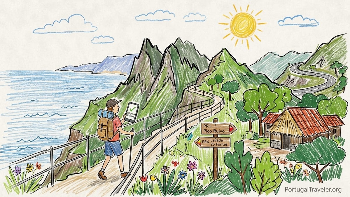
How Hiking in Madeira Works in 2026
Since early 2026, all officially classified PR walking trails in Madeira managed by the regional nature authority require advance booking on the SIMplifica government portal. The general fee for visitors is around 4.50 euros per trail, with some exceptions such as combined products for PR1 and multi-day passes. Children under 13 and Madeira residents are exempt from paying but still need a reservation, and several guided operators have their own access arrangements that sit on top of this system. Entry is organised in 30-minute slots, which is especially noticeable on headline routes like PR1 and PR6 where early slots sell out quickly on weekends.
On the ground, the most important change for hikers is that you cannot simply “turn up and see.” Trail status is now clearly flagged as open, restricted or closed in the official listings and mirrored in the SIMplifica booking screen. If a walk is closed for weather or maintenance, there is no bookable slot and no legal access. This is not theoretical. On my last trip I had a PR13 booking cancelled the day before because of high-wind alerts, and the only reason I knew early enough to re-plan was because I checked SIMplifica again the night before. Anyone putting together a hiking-based Madeira itinerary now needs a short daily ritual of checking trail status, in the same way you might check a mountain weather forecast.
In this context, it makes sense to think of Madeira hikes regionally and thematically. The island’s official walks fall broadly into high mountain traverses, deep laurel forest levadas, high plateau and moorland routes, and short coastal or balcony paths that nibble at the edge of cliffs. In this article I concentrate on several trails I have walked more than once since 2023 and again after the 2026 changes, and which I would still willingly repeat: the mountain axis between Pico do Areeiro and Pico Ruivo, the Rabaçal levada cluster around PR6, the laurel forest balcony of PR9 Caldeirão Verde, the fanal forest ridge of PR13, and the coastal and balcony experiences around Boca do Risco and Câmara de Lobos. Rather than dissecting each PR as a standalone guide, I will compare how they feel, who they suit and what has changed in practice.
Central Mountains: Areeiro to Ruivo and Achada do Teixeira
The spine of Madeira’s high mountains is still the island’s defining hike. In 2026 PR1 has been split operationally into partial products, but on the ground the classic experience remains a committing ridge walk between Pico do Areeiro and Pico Ruivo. My most recent full traverse from the Areeiro car park to Achada do Teixeira, combining PR1 with PR1.2, covered roughly 13 kilometres with around 900 metres of ascent and 1200 metres of descent, and took me just under 6 hours of moving time, plus another hour of stops for photos and shelter time in the hut below Pico Ruivo when a squall blew through.
This is not a levada stroll. The path is engineered with hundreds of steps cut into the rock, narrow ledges protected by steel cable and handrail, and several tunnels where a headlamp or phone torch is essential. Under dry conditions the rock is grippy, but after rain the steps collect slick mud in places and the clay sections between staircases can be surprisingly greasy. On my last traverse I wore mid-cut waterproof hiking boots and used trekking poles, and I was glad of both on the steep zigzags down from Areeiro and again on the long descent from Ruivo to Achada do Teixeira. Running shoes with decent grip are fine for experienced mountain walkers, but anything with smooth soles will make this feel twice as serious.
Exposure is constant but usually manageable. The narrowest traverses have handrails and, in calm weather, feel more dramatic than dangerous. In cloud or wind this changes quickly. One April traverse a couple of years ago took me 5 hours in dry but grey conditions. My most recent walk after the SIMplifica changes, in late spring 2026, started in full sun at Areeiro and then spent nearly two hours in cold, gusty cloud between the main tunnels. Temperatures dropped far below Funchal’s coastal warmth and the rock sweated with condensation. The region’s “moderate to difficult” rating is absolutely fair in my view, but only if visitors understand that the difficulty comes from exposure, weather and sustained stair climbing, not from any single scrambling move.
Logistically, the 2026 system has squeezed spontaneity here more than on any other trail. The Areeiro car park now has attendants checking bookings at peak times, and SIMplifica enforces 30-minute waves that thin out the initial rush. In practice the trail still feels busy by mid-morning. On my last traverse I chose a slot just after sunrise and parked without paying for private parking, then used a pre-booked taxi from Achada do Teixeira back to the car for around 40 euros for two people. There are toilets at the Areeiro café and simple facilities again at the Ruivo refuge, but nothing in between. Water can be bought at the start and at the Achada do Teixeira bar at the far end, but I still carried two litres each, more on hotter forecasts. Of all the hikes in this article, the Areeiro to Ruivo axis delivers the most intense scenery per kilometre and still feels unforgettable, provided you treat it as a true mountain day rather than an upgraded miradouro stop.
The Rabaçal Basin: 25 Fontes, Risco and Alternative Levadas
The Rabaçal area concentrates several of Madeira’s most famous levada walks. Officially this is the home of PR6 Levada das 25 Fontes and PR6.1 Levada do Risco, but on foot the experience is a wider basin of trails and channels that intersect and overlap. I have walked into 25 Fontes from both the upper ER110 viewpoint and via the Rabaçal forestry road, and have linked PR6 with levada segments signposted toward Lagoa do Vento and the older PR6.4 levada section. The official PR6 distance of roughly 4.5 to 8 kilometres, depending where you count from, hides the fact that most visitors will cover around 9 to 11 kilometres with cumulative ascents of 400 to 500 metres if they include Risco and the walk back up to the road.
Terrain here is classic levada: narrow paths hugging a water channel, often concreted but broken in places, with frequent roots, stone steps and short sections where the levada edge is your only handrail. In several places the drop beside you runs tens of metres down into forest. The trail is officially graded as moderate, and in dry weather that fits my experience. After heavy rain, however, the 25 Fontes spur in particular becomes a churned mud corridor as hundreds of boots funnel to the same viewpoint. On a wet November day in 2025 I needed nearly 4.5 hours to complete a loop that had taken just over 3 hours in a drier April; the bottleneck at the pool added another 20 minutes of queueing for photos. Waterproof hiking shoes and gaiters made the difference between accepting the mud as part of the fun and spending the rest of the day in soaked jeans.
Rabaçal is where the 2026 reservations have done both the most good and the most visible harm. On the positive side, timed entry has noticeably reduced the worst of the canyoning-style crowds that used to swamp the levada at midday Sunday. My last walk, starting on an early slot, felt reasonably calm on the outward leg, with only a steady stream of people. On the negative side, the combination of tour groups, rental-car visitors and strict entry windows has made the lower road and unofficial parking creatively chaotic on busy days. The official Rabaçal shuttle and marked parking area help, but arriving a full 30 to 45 minutes before your slot is now common sense. Toilets and a café exist at the Rabaçal forestry house, but there are no services at the trailhead upstairs on the main road, and very limited water refills once you are moving.
Scenically, the Rabaçal basin excels in variety rather than single big vistas. Risco waterfall feels tall and elegant, especially after rain, while the 25 Fontes pool in dry conditions can underwhelm if you are expecting an alpine amphitheatre. For me this area wins as an immersive levada experience: long stretches of soft forest light, moss-coated walls, and the sound of water everywhere. It is the hike from this list that I would most recommend to a first-time levada walker in reasonable fitness, especially if they are staying on the south-west of the island and want something atmospheric without committing to cliff exposure or big altitude.
Laurisilva Balcony: PR9 Caldeirão Verde and Beyond
If Rabaçal is dense and social, the laurel forest above Santana feels more introverted. PR9, the walk to Caldeirão Verde from Queimadas, has been one of my repeat hikes for years. Official data lists a return distance of around 12 kilometres with a modest ascent of 100 to 150 metres, but what matters more is the sustained narrowness and exposure of the levada balcony. My personal timings have hovered around 4 to 4.5 hours of moving time, with some groups I have walked with taking closer to 5 hours once photo stops and snack breaks under the overhangs are added.
The path chisels along a near-vertical forested wall. In good weather you progress through a tunnel of moss and overhanging branches, with openings that drop steeply into a deep, V-shaped valley. Several sections have handrails, but there are still places where the outer edge of the levada is only as wide as a boot and the inner side is wet rock. Four tunnels punctuate the route, the longest taking several minutes to walk through. Here a headlamp is not optional. Even if your eyes adjust, the uneven floor, water drips and occasional low ceiling make stumbling in the dark a real risk. I carry a compact hiking torch and a spare, and I am stricter about this here than anywhere else on the island.
Despite the modest ascent, PR9 can be more demanding psychologically than Rabaçal. Anyone with a strong fear of heights may find the exposure uncomfortable and the tunnels unsettling. The trail’s official moderate rating matches my physical experience but perhaps understates the mental load for novice hikers unused to walking along drop-offs. Footwear that grips well on wet rock is crucial. I have done this trail once in lightweight trail-running shoes with sticky soles and once in heavier boots; I noticeably preferred the runners for their precision on narrow ledges, as long as the forecast did not threaten continuous rain.
In 2026 the SIMplifica system has made Queimadas car park feel more ordered. Early reservations spread arrivals a little, and on my last visit in shoulder season I found a space without circling. Parking is still limited, however, and in peak weeks the municipal attendants will turn people back once the lot fills, regardless of whether they hold valid trail bookings. There are public toilets and a small café near the traditional thatched houses at Queimadas, but nothing on the trail itself. Water bottles can be topped up from the café or bought in Santana supermarkets beforehand. Weather here tends to be damp and changeable; one spring hike began in bright sun and ended in dripping mist, with my waterproof shell earning its keep for the last hour back from the waterfall.
Western Highlands: PR13 Fanal and the High Plateau
The western side of Madeira offers a different hiking mood altogether. PR13 Vereda do Fanal, linking the Paul da Serra plateau with the Fanal forest, has become one of my most repeated walks, partly because its logistics are flexible. The official trail runs around 10 kilometres with 500 to 600 metres of descent when walked from the plateau down to the ancient laurel trees of Fanal. My last descent from the Paul da Serra roadside parking to the Fanal picnic area took 3 hours of unhurried walking and photography, followed by another 45 minutes wandering the fog-sculpted trees at the bottom.
Terrain here is a mix of broad earthen path and narrower singletrack. In dry weather the trail feels almost pastoral, with grassy ridges, low heather and volcanic soil underfoot. After rain it transforms into a mud ribbon, particularly in the sections where the trail dips into small hollows. My muddiest day on Madeira was a winter PR13 descent when knee-deep sections turned much of the path into an obstacle course. On that occasion hiking boots were non-negotiable and gaiters would have been a good idea. Trekking poles help with balance on the steeper, slick parts, especially if you choose to reverse the trail and climb from Fanal back to the plateau, which turns it into a more strenuous outing.
Exposure here is more about weather than sheer drops. The open plateau catches wind and low cloud, while Fanal is famous for its photogenic mist which, in reality, often means brief disorientation and damp clothing. Visibility can change from wide Atlantic panoramas to 30 metres of grey in minutes. Official difficulty ratings class PR13 as moderate, which aligns with my sense of the physical demand for normally fit walkers starting from the plateau and descending. Climbers tackling it uphill may find it on the harder side of moderate. There are no tunnels and minimal cliff-edge exposure, making this a psychologically easier option than PR1 or PR9, but you should still treat it as a proper day hike.
From a 2026 logistics viewpoint, PR13 feels less constrained than PR1 or PR6. SIMplifica reservations are still compulsory, but the trail sees fewer large tour groups and parking on the Paul da Serra roadside remains informal and usually sufficient outside of holiday weekends. Fanal’s lower end has a picnic area, small café kiosk in season and basic toilets, which are useful if you arrange a taxi pick-up there. In my case, I have alternated between out-and-back walks starting and ending at Fanal and one-way traverses using a pre-arranged transfer. For many visitors, PR13 offers the best chance to experience Madeira’s laurel forest in semi-solitude, especially on grey days that discourage coastal crowds.
Coastal and Balcony Trails: Vereda do Larano and South Coast Paths
While not all coastal balcony paths are yet wrapped into numbered PR routes, several have become regular fixtures in my Madeira hiking weeks. The balcony path above the north-east coast between Machico and Porto da Cruz, often linked in itineraries under the name Vereda do Larano, offers a very different experience to levadas and summit traverses. Distances vary with the exact start and end points, but my preferred route, from the viewpoint above Machico through the Larano balcony and down into Porto da Cruz, measures around 11 to 12 kilometres with 500 to 600 metres of ascent and descent combined. My typical moving time has been 4 hours, stretching to 5 with photo stops and a coffee at the café on the seafront in Porto da Cruz.
The path here is cut into steep coastal slopes, with sections of narrow balcony where the drop to the ocean is considerable but usually buffered by scrub and handrails. The surface alternates between packed dirt, stone and some concrete reinforcement. In dry conditions this feels like a moderately exposed walk suitable for experienced beginners who are not troubled by heights. After rain or in strong wind, the outer edge can feel intimidating, and I have turned around once when gusts coming off the sea made balance on the narrowest section uncomfortable. Compared with PR1, there are fewer steps and no tunnels, но the combination of exposure and lack of escape routes means you should still take weather seriously.
On the south coast, balcony and village-to-village paths above Câmara de Lobos and Cabo Girão have become my go-to half days when the mountains are socked in. These walks are often a patchwork of local paths, short unofficial levadas and quiet lanes linking viewpoints. Because they are not always part of the official PR catalogue, they currently sit outside the SIMplifica reservation system, but rules are changing fast and anyone visiting in late 2026 or beyond should confirm which segments, if any, have been brought under formal management. Distances range widely; I have stitched together 8- to 10-kilometre loops with 400 metres of ascent that start and end at village bus stops, allowing me to leave the rental car in Funchal.
These coastal routes are less about raw wilderness and more about human landscape. You pass banana terraces, small bars where a glass of fresh passionfruit juice costs only a few euros, and miradouros with Atlantic views framed by concrete picnic tables. Underfoot the mix of pavement, cobbled steps and narrow dirt tracks benefits from cushioned shoes or lightweight hikers rather than heavy boots. Crowding is rarely an issue away from the most famous Cabo Girão viewpoints, and toilets and water refills are much more frequent than in the mountains. For travellers who want a taste of walking culture without committing to long PR routes, these balcony links offer a forgiving entry point.
Comparing the Experiences: Crowds, Scenery and Who Each Hike Suits
Across these different regions, patterns emerge that can help first-time visitors choose where to focus. In terms of pure scenery, my vote still goes to the central mountains between Pico do Areeiro and Pico Ruivo. No other trail in Madeira combines such dramatic ridge lines, vertical rock architecture and shifting cloud theatre in such a compact distance. Every traverse feels different. One spring morning I watched the first light catch the north cliffs while the south side still sat in ink-blue shadow; another day the entire ridge dissolved into fog and only the odd rock tower materialised out of white. If you can handle exposure, stair climbing and variable weather, this is the hike I would repeat the most often for spectacle alone.
In contrast, the trail that feels most overcrowded in my experience is PR6 Levada das 25 Fontes, especially at the waterfall bowl itself. Even with 2026’s timed entry and lower-capacity slots on the booking portal, the physical layout funnels everyone to one narrow basin. On my last visit, we arrived mid-morning and counted at least eight small guided groups in the immediate area, plus dozens of independent walkers. It was still enjoyable, but it felt more like queuing in a scenic corridor than losing yourself in nature. Starting on the first available slot of the day and moving briskly to 25 Fontes before turning the hike into a wider levada loop helps, but anyone who values solitude above all else may prefer PR9, PR13 or the less-known coastal balconies.
The hike that surprised me most in terms of difficulty was PR9 Caldeirão Verde. On paper, the small ascent and out-and-back nature might suggest an easier day than PR6. In reality, the exposure, slippery rock and tunnels demand more concentration, and I have watched inexperienced walkers freeze briefly on narrow sections when another group needed to pass. It is not a route I would choose for someone who has never walked on steep ground, even if they are otherwise fit. By comparison, PR13 felt physically harder on muddy days but more forgiving from a psychological standpoint, thanks to its broader paths and lack of big drop-offs.
For a genuine first-time hiker who is reasonably active but new to mountain walking, my top recommendation would be a carefully chosen version of the Rabaçal basin. A loop that includes PR6 to 25 Fontes, a detour to Risco and a return via quieter levada segments offers a good introduction to Madeira terrain: some steps, some roots, moderate exposure and reliable forest shade. The presence of a café and toilets at Rabaçal, the option of using the shuttle to reduce ascent, and the ability to shorten or lengthen the day based on how the group feels all add to its suitability. If crowds are a concern, pairing Rabaçal with a second day on PR13 or the south-coast balcony paths gives a more rounded and less congested picture of the island’s walking culture.
Planning Around SIMplifica, Weather and Logistics
Under Madeira’s 2026 regime, success on the trails now begins at your laptop or phone. Once you have sketched a rough itinerary based on regions rather than isolated highlights, the next step is to open the SIMplifica portal and check which trails are currently open, restricted or closed on your intended dates. Restricted status can mean anything from reduced capacity to temporary diversions; closed status means that bookings are unavailable and access is off limits. Because closures for weather or maintenance can trigger refund or rescheduling options through the official channels, it is vital to keep an eye on status changes right up to the day before your booking, not just when you first reserve a slot.
With reservations in place, logistics on the day still require attention to detail. For point-to-point hikes like Areeiro to Ruivo plus Achada do Teixeira, arranging a transfer in advance removes stress. Local taxi firms in Santana and Funchal are used to one-way hiker pickups and, in my experience, have been reliable when booked the night before, with prices in the 35 to 50 euro range depending on distance and waiting time. For circular or out-and-back trails such as PR9 and many Rabaçal options, driving and parking at the start is easy enough outside of peak hours, but high summer and holiday weeks can bring full car parks and road controls. Factor in a buffer of at least 30 minutes between your planned arrival time and the start of your SIMplifica slot.
Weather is the other non-negotiable factor. Madeira’s microclimates can produce bright sun in Funchal and cold rain or cloud at 1500 metres on the same day. I now habitually check a combination of general forecasts and mountain-specific outlooks, and I carry layers that would be more typical of alpine day hikes than of a sub-tropical island. On every route mentioned here I bring a lightweight waterproof jacket, a warm mid-layer, a headlamp, at least 1.5 to 2 litres of water per person and enough food to turn the outing into a full day if necessary. Toilets are scarce once you leave trailheads, and water sources along levadas are not treated, so treating surface water or relying on purchased supplies remains prudent.
Footwear, finally, deserves more attention than many visitors give it. Madeira’s combination of stone steps, slick clay, roots and often wet rock rewards shoes with aggressive tread and good wet-grip rubber. I have completed these hikes in both mid-cut hiking boots and sturdy trail-running shoes. For the high mountains and the muddiest days on PR13, boots provided better ankle support and warmth. For levada balconies and coastal trails, lighter shoes kept fatigue and blisters at bay. What I would avoid entirely are fashion trainers with shallow tread or hard soles, which I have seen slip on simple down steps more than once. A pair of collapsible trekking poles tucked into a daypack adds little weight and makes long descents and muddy sections significantly more comfortable.
FAQ
Q1. Do I really need to book Madeira’s PR hikes in advance in 2026?
Yes. Access to all classified PR walking trails managed under the current system now requires advance booking through the SIMplifica portal, including a specific date and 30-minute entry window. Some less formal local paths and village connectors remain outside the system for now, but you should assume that headline routes such as PR1, PR6, PR9 and PR13 all require reservations and often fill early.
Q2. How much do Madeira hiking reservations cost under the new system?
The standard fee for visitors is around 4.50 euros per person and per trail, paid online at the time of booking. Certain products, such as the long mountain traverse or multi-day passes, use slightly different pricing, and Madeira residents, young children and some other categories are exempt from payment while still needing a reservation. Always check the current fee table before confirming your itinerary.
Q3. What happens if my booked trail is closed due to weather?
If a PR trail is officially closed for reasons such as storm warnings or maintenance, bookings for that day are usually blocked or cancelled. Under the current rules, closures attributable to the authorities can trigger options to reschedule or request a refund, typically through official channels listed on the SIMplifica or nature authority websites. You will need to keep your booking confirmations and follow the specific instructions provided at the time.
Q4. Which Madeira hike offers the best scenery for a one-day effort?
In my experience, the combination of PR1 from Pico do Areeiro to Pico Ruivo and the continuation down PR1.2 to Achada do Teixeira delivers the most dramatic mountain scenery in a single day. Expect around 13 kilometres, significant ascent and descent, tunnels and cliff-edge traverses. It is not suitable for everyone, but for fit hikers comfortable with exposure it is the standout visual experience on the island.
Q5. Which levada or trail feels most crowded under the 2026 system?
PR6 Levada das 25 Fontes, particularly the final basin at the waterfalls, remains the most crowded walk I repeat. Even with timed entry, the narrow layout concentrates people at the viewpoint. Starting early in the day, extending your walk onto quieter levada segments and managing expectations helps, but those seeking solitude may prefer PR9 or PR13 instead.
Q6. Is Madeira hiking suitable for first-time hikers?
Yes, with careful route choice. I generally recommend the Rabaçal basin and variants around PR6, or gentle balcony paths above the south coast, for first-timers. These options offer well-marked trails, some facilities at trailheads and moderate ascent, while still delivering classic levada scenery. Complete beginners should avoid committing mountain traverses like PR1 until they have some experience on uneven and exposed ground.
Q7. What footwear should I bring for Madeira’s PR trails?
Sturdy shoes with good grip on wet rock and mud are essential. Lightweight hiking boots or trail-running shoes with aggressive tread both work well, depending on your preference. I reserve mid-cut waterproof boots for higher, colder or muddier routes such as PR1 and PR13, and use breathable trail shoes on coastal paths and some levadas. Fashion sneakers with smooth soles are not a good idea.
Q8. Are there toilets and water on the trails?
Facilities are limited once you leave trailheads. PR1 has toilets at Pico do Areeiro and near Pico Ruivo, Rabaçal has a café and toilets at the forestry house, and Queimadas and Fanal offer basic services at their respective car parks. Many stretches of PR6, PR9 and PR13 have no toilets or safe drinking water points. Plan to carry all the water you need and treat any surface sources before drinking.
Q9. Can I hike without a car and use public transport instead?
It is possible but requires more planning. Some trailheads, such as those near Santana or along the south coast, are reachable by scheduled buses from Funchal, followed by short taxi rides or road walks. Others, including Pico do Areeiro and Paul da Serra, are not well served by public transport, so arranging private transfers or joining guided excursions may be more practical if you do not want to rent a car.
Q10. How early should I book popular Madeira hikes on SIMplifica?
For very popular routes like PR1 and PR6 in peak months, booking several weeks in advance is wise if you want early-morning slots or have a fixed itinerary. Shoulder-season visits may allow more flexibility, but weekend and holiday dates can still fill quickly. Less frequented trails such as PR13 often have availability closer to the date, but it is still sensible to secure your reservations once your travel dates are firm.