


I picked up my rental car at Lisbon Airport on a hot afternoon in late September and immediately understood that the success of an Alentejo trip would depend on road decisions. I had booked a compact automatic through a major agency at the terminal, added full coverage to avoid debates about stone chips from rural roads, and accepted the Via Verde toll transponder that charges motorway fees automatically to the contract. The fuel policy was full-to-full, and I was arriving from Lisbon rather than the Algarve or Spain, determined to drive a loop across Alentejo’s interior towns before dropping down to the Atlantic and back.
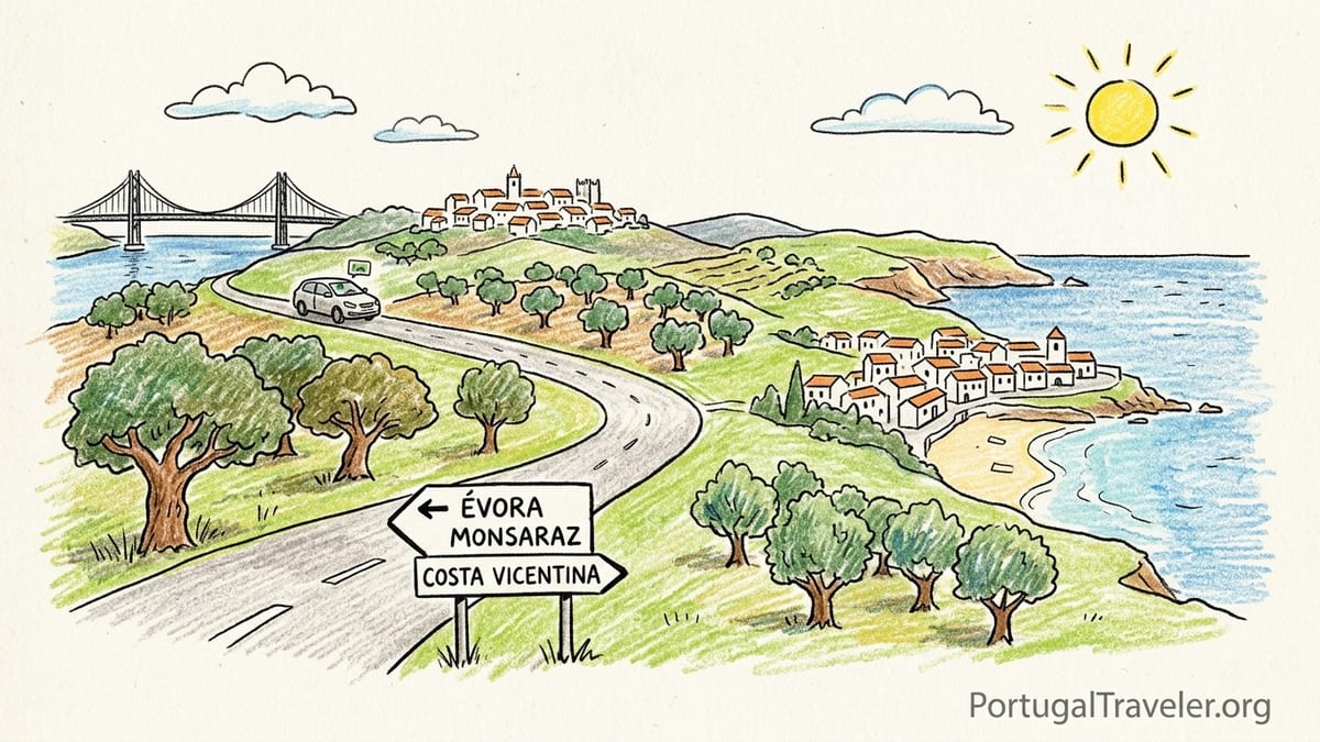
Collecting the Car and Leaving Lisbon
At Lisbon Airport, most big-name rental desks sit in a single hall and feed into a multi-level car park. I waited around 25 minutes in line, then another 10 while a staff member checked the car for damage. The automatic transmission cost noticeably more than a manual, but knowing I would be dealing with unfamiliar towns, steep cobbled lanes and occasional hill starts, I judged the premium worth it. I added the rental company’s own full coverage instead of relying only on my credit card insurance, because rural Alentejo is full of gravel lay-bys, tight village parking and the odd low stone wall you notice only at the last second.
Accepting the Via Verde toll device was the easiest decision of the day. The clerk explained that all motorway tolls would be billed through the transponder with a small daily convenience fee, which meant I could use the A2 and A6 without hunting for toll booths or worrying about electronic-only stretches. With the contract printed and keys in hand, I wove out of the airport and straight onto the Lisbon ring road toward the Ponte 25 de Abril bridge, already feeling the mental shift from city driving to open-country highway.
Leaving the metropolitan tangle took about 30 minutes in late-afternoon traffic. Google Maps claimed Lisbon to Évora via the A2 and A6 would take around 1 hour 30 minutes. In practice, between roadworks outside Lisbon and a brief fuel stop on the A6, it was closer to 1 hour 50 minutes before I was easing off the motorway and seeing Évora’s medieval walls ahead. That small gap between the estimate and reality would become a theme of the trip.
Lisbon to Évora: First Taste of the Plains
The A2 south and A6 east are classic Portuguese motorways: smooth, relatively empty once you clear the capital, and dotted with well-marked service areas every 40 to 60 kilometers. Tolls are not cheap, but for this first leg they are worth it. Even with the extra time, the drive felt easy compared to what was coming deeper in Alentejo. The landscape shifted quickly from suburban Lisbon to rolling plains, first with eucalyptus and then with the cork oak and olive trees that define the region.
I deliberately skipped the toll-free N4 alternative this time, though I had studied it on the map. On paper it adds about 30 minutes, but regulars told me that slow lorries, village speed limits and tractors can stretch that even further. With a limited number of days and my internal clock still on airport time, I wanted to arrive in Évora with enough afternoon light to orient myself inside the walls.
Finding parking in Évora was the first practical lesson. I drove impulsively through one of the gates and spent 20 anxious minutes threading along narrow streets, worrying about scraping mirrors and trying to avoid pedestrian priority alleys. Eventually I gave up and circled out to park in a signed public lot just outside the walls near the aqueduct, where surface spaces cost a few euros for the whole afternoon. It meant a 10 to 15 minute walk back through the gate with luggage, but the lower stress of not maneuvering around stone corners with a rental car was worth every step.
Évora itself deserves at least two nights. I had only booked one, assuming that I could see the main Roman temple, the cathedral roof and the Chapel of Bones in a concentrated afternoon and morning, then push on. That choice created a low-level rush that followed me for the next couple of days. Looking back, a second night would have allowed a slower start and a less tiring onward drive toward the Spanish border.
Évora to Monsaraz: Misjudging “Nearby”
The next morning I pointed the car toward Monsaraz, the iconic hilltop village above Alqueva Lake. The map suggested about one hour via Reguengos de Monsaraz on mostly national roads. It felt short enough that I added a winery visit outside Évora before leaving, which turned out to be my first real mistake. A leisurely tasting and early lunch stretched into mid-afternoon, and I then faced an hour’s drive along N and municipal roads in 32-degree heat with a slightly fuzzy head.
The route from Évora to Reguengos is straightforward, but it is not fast. The road alternates between long straight stretches across the plains and slow entries into small towns with roundabouts, school crossings and agricultural vehicles. I stopped once for fuel in Reguengos, discovering that prices there were noticeably lower than on the motorway. The station was self-service with a pay-at-pump option, but the staff were quick to help when my foreign card hiccuped. From there it was another 20 to 25 minutes to Monsaraz, with the final approach climbing sharply toward the whitewashed village on its ridge.
Here, my second parking lesson arrived. Instead of following the first large car park signs below the town, I optimistically kept driving up, hoping for a space closer to the gate. By the time I realized every slot was full, I was nose-to-nose with a tour minibus on a constricted bend, inching mirrors past stone. Eventually I reversed back down and parked in the main lot outside the walls, which is free or low cost depending on the season and leaves a 10 minute uphill walk to the gate. It would have been far less stressful to accept that walk from the start.
Afternoon in Monsaraz is magical, but it also reinforced a safety rule. I limited myself there to a single glass of wine with a late café snack and plenty of water, because the return drive to my accommodation near Reguengos involved the same rural roads with scattered lighting and frequent wildlife. Even in early evening, visibility falls quickly once you leave the village lights, and I was grateful for clear signage and reliable mobile coverage for navigation. Backtracking this route twice in one day, however, left me more tired than the distance suggested.
Crossing to Beja and Down to the Atlantic Coast
From the Monsaraz area I headed south toward Beja before cutting across to the coast. On the map, Reguengos de Monsaraz to Beja looks like a pleasant diagonal, roughly 90 minutes via IP2 and regional roads through the agricultural heart of Baixo Alentejo. The reality was a morning of concentrated driving. The roads are generally good, but they pass through towns at regular intervals, and the speed limits change frequently. Trucks hauling grapes and olives after harvest season added rolling chicanes to the route.
Beja is not as immediately photogenic as Monsaraz or Évora, but its castle and quiet historic center make a worthwhile pause. I spent about two hours there, which was just enough for a short walk and a coffee in a shaded square. Unfortunately, I then made my biggest timing error of the trip: I decided to push all the way from Beja to Vila Nova de Milfontes on the same day. The map promised about 1 hour 45 minutes via IC1 and then west on smaller roads, and I was tempted by the idea of arriving at the ocean by sunset.
The first part of that leg toward Ourique and then west passes through an increasingly open, empty landscape of cork oak, eucalyptus and grazing land. Fuel stations become less frequent outside the main junctions, so I topped up in Ourique even though I still had half a tank. That conservative decision paid off later on smaller coastal roads where stations are rarer and sometimes close early. Mobile signal held for most of the way, but there were enough dead spots that I was glad I had downloaded offline maps before leaving Beja.
By the time I descended toward the Mira River and Milfontes, fatigue had set in. What had been planned as two medium drives, Beja and then Beja to the coast, became one overloaded day in the car. I arrived at my guesthouse at dusk after about four and a half cumulative hours of driving with only short breaks. The town streets in Milfontes are better lit than some inland villages, but the final search for parking near the historic center in failing light still felt like threading a needle with dull reflexes.
Milfontes and Porto Covo: Where the Road Becomes the Destination
Once on the Atlantic, the character of the driving changed completely. The stretch between Vila Nova de Milfontes and Porto Covo is part of the Costa Vicentina, and even if you are not walking the Rota Vicentina trails, much of the joy lies in pulling off at unsigned dirt tracks that lead to empty coves and viewpoints. Distances are short in kilometers, but they stretch in time when you are stopping constantly.
On my main day along this section, I left Milfontes mid-morning, crossed the Mira on the bridge and headed north on the coastal road. The map suggested 35 to 40 minutes of pure driving time to Porto Covo. I turned it into a three hour meander, nosing the car down spur roads to beaches like Malhão and smaller unnamed viewpoints. Many of these side tracks are unpaved and dusty, but manageable in a regular compact car if you keep speeds low and avoid the deepest ruts. This is also where the decision to take full insurance felt particularly wise.
Arriving in Porto Covo at lunchtime, I found parking relatively straightforward in shoulder season, using a gravel lot slightly above the main square. It was an easy five minute walk down to the low white houses and blue-trimmed facades clustered around the plaza. From there, I walked the clifftop path rather than continuing further by car, looking south across the coves that hikers follow toward Vila Nova de Milfontes and, beyond that, Odeceixe. Here more than anywhere, the landscape made the driving worthwhile. The simple act of linking Milfontes and Porto Covo is a highlight in itself, not just a transfer between towns.
Returning to Milfontes in the late afternoon, I chose the same coastal road instead of cutting inland. The low sun turned the fields golden, and I understood why many experienced visitors recommend staying multiple nights at both an inland and a coastal base. If I had not been tied to a pre-booked inland stop the next day, I would gladly have added another night on this coast simply to drive shorter stretches and let the day float between coves and cafés.
Back Inland via Comporta: Beauty and Backtracking
My plan from Milfontes was to turn north toward Comporta and the Sado estuary before looping back to Lisbon. On paper, Milfontes to Comporta is roughly two hours if you combine regional roads with a stretch of motorway closer to the capital. I made it harder for myself by trying to avoid tolls and hugging smaller roads through the rice fields and pine forests.
The first part north from Milfontes toward Sines was straightforward, with good surfaces and light traffic. Near Sines I ignored the motorway ramps and followed signs for local coastal routes, lured by the idea of “staying close to the sea.” That decision slow-burned the day. The road wound through roundabouts, small industrial zones and settled areas where 50 kilometer per hour limits are strictly enforced. By the time I approached the rice paddies south of Comporta, I had been driving nearly three hours, including a brief coffee stop and a wrong turn onto a farm track that cost another 10 minutes to correct.
Comporta itself is a compact village with a beach access road stretching west. Parking in the village in late afternoon was surprisingly tight. I ended up leaving the car on the edge of a dusty overflow area ten minutes’ walk from the cafés, a small replay of the Monsaraz lesson. The beach car park closer to the dunes charges a modest daily fee and fills quickly on sunny days, and in hindsight I would have aimed directly there rather than circling the village streets.
From Comporta to Lisbon there are two main options: continue north and cross the long bridge over the Sado estuary, or detour to Setúbal and take the ferry back toward the capital. Timetables and queues can make the ferry unreliable when you are already tired, so I stayed on the road and joined the motorway. With the Via Verde transponder, the tolls processed automatically, and about 1 hour 30 minutes later I was crossing back into the Lisbon metropolitan area. That final run crystallized a lesson. I had created unnecessary backtracking by trying to do too much coastal and inland Alentejo in one loop.
Driving Conditions, Safety and Fatigue
Over the course of this Alentejo trip I averaged between 1.5 and 3 hours of driving on the days I changed bases. That might not sound extreme, but the cumulative effect of repeated 1 to 2 hour stretches on secondary roads is real. Many of Alentejo’s N and regional roads are well surfaced and lightly trafficked, yet they demand attention. You share space with tractors, cyclists, herds being moved between fields and unexpected speed bumps at village entries.
Lighting varies significantly. Approaches to larger towns like Évora, Beja and Sines are lit, but long intervals between them are dark after sunset, with only vehicle headlights piercing the fields. I tried to avoid driving at night, but restaurant dinners in inland towns inevitably pushed a couple of journeys into twilight. On those occasions I reduced speed below the limit and increased following distances, both because of animals and because my own reaction times felt dulled after long days.
Mobile signal and navigation were mostly reliable on the Lisbon motorways and main N roads. Coverage dipped near the Spanish border around Monsaraz and in some of the lower valleys between Beja and the coast, occasionally enough for my navigation app to stutter. Downloading offline maps for the entire Alentejo region before leaving Lisbon proved essential. It also spared data roaming worries when my phone briefly latched onto Spanish networks along higher ridges.
By the end of the trip, I found myself recalibrating what “nearby” meant in Alentejo. Two points 70 kilometers apart on the plains are technically close, but the combination of slower average speeds, breaks for photos and the gravitational pull of wineries and viewpoints means those drives often consume a full morning or afternoon. Squeezing more than one significant relocation into the same day, as I did with Beja and the run to Milfontes, turned pleasant roads into a slog.
What I Would Do Differently: A Revised Route
Alentejo’s dispersed fortified towns, vineyards, Alqueva Lake and long coastal strip make road planning central to the experience. Having now driven a loop that felt slightly too ambitious, I would change three elements if I repeated the trip. First, I would add a second night in Évora at the start and resist the temptation to pack a winery visit into the transfer day to Monsaraz. That would turn the Évora to Monsaraz run into a fresh morning drive of around an hour and leave time for a long lunch looking over the lake without worrying about the return journey.
Second, I would avoid stacking Beja and the coast on the same day. Instead of sleeping near Reguengos and then connecting Reguengos, Beja and Milfontes in one push, I would choose a base near Beja or in the countryside south of Évora for two nights. One full day could be dedicated to exploring Beja and nearby towns without a heavy driving burden. The following morning I would then drive from that base directly to the coast, accepting a 2 to 2.5 hour transfer as the main activity of the day, with only one or two short stops.
Third, I would structure the coastal portion as at least two nights each in Vila Nova de Milfontes and Porto Covo or another small village on that stretch. Instead of backtracking Milfontes to Porto Covo in a single day trip, I would drive north from Milfontes through the coves, stay in Porto Covo, and continue onward the next day, whether deeper into the Alentejo coast or curving back inland toward Comporta. This would keep daily driving to under 90 minutes while still allowing time for walks on the Fishermen’s Trail sections and long seaside lunches.
Finally, I would accept the value of motorways more readily. For returns toward Lisbon or repositioning days between inland clusters, the A2 and A6 save energy that is better spent wandering inside walled towns. Secondary roads should be reserved for the segments where the landscape itself is the attraction, such as the plains between Évora and Monsaraz and the entire run between Milfontes and Porto Covo.
The Takeaway
Driving across Alentejo is less about ticking off towns and more about understanding how distance feels in a rural region. On a map, Évora, Monsaraz, Beja, Comporta, Vila Nova de Milfontes and Porto Covo can all be connected in a week. Behind the wheel, the cumulative concentration of narrow gates, unlit stretches and one-hour “short hops” that expand with stops makes a compelling case for doing less.
My main lessons are simple. Pick no more than two inland bases and one coastal base for a week, give yourself full days with no major relocations, and use toll motorways strategically to reposition between clusters. Park outside walled centers even if that means hauling bags a little farther. Build winery visits into days when you are not shifting bases, and keep at least one meal a day within walking distance of your bed. Above all, remember that in Alentejo, the stretches of road between fortified hilltops and Atlantic cliffs are not filler. They are the trip.
FAQ
Q1. Is an automatic car necessary for an Alentejo road trip?
An automatic is not strictly necessary, but it can make the experience less stressful, especially in hilly walled towns like Évora and Monsaraz where you face tight corners, cobbles and frequent hill starts. If you are not fully confident driving a manual in these conditions, the extra cost of an automatic is worth considering.
Q2. How many hours a day should I plan to drive in Alentejo?
A comfortable target is 1 to 2 hours of actual driving on days when you change bases, with plenty of buffer for photo stops and small detours. Back-to-back days of 3 hours or more, particularly on secondary roads, can quickly become tiring and leave less energy for exploring the towns themselves.
Q3. Are toll roads worth paying for in this region?
Yes, especially when entering or leaving Lisbon or repositioning between distant parts of Alentejo. Motorways like the A2 and A6 are faster, smoother and less mentally demanding than N roads, which pass through many towns and have varying speed limits. Combining toll roads for long stretches with slower scenic segments works well.
Q4. How difficult is parking in towns like Évora and Monsaraz?
Parking directly inside walled centers can be challenging due to narrow streets and limited spaces. It is usually easier to use signed public car parks just outside the walls and walk 10 to 15 minutes to your accommodation or the historic core. This reduces stress and the risk of scraping a rental car on stone walls.
Q5. Is it safe to drive after visiting wineries in Alentejo?
Hundreds of visitors do winery tours safely, but the key is planning. Schedule tastings on days without long transfers, limit alcohol intake to what keeps you fully in control, drink plenty of water and build in rest time before getting back on rural roads that may be dark and lightly marked after sunset.
Q6. Do I need to worry about fuel stations in rural Alentejo?
Fuel stations are common in larger towns and along motorways, but can be sparse in remote inland areas and on some coastal stretches. It is sensible to refuel when you reach half a tank, particularly before driving between Beja and the coast or along the less developed parts of the Atlantic.
Q7. How reliable is mobile signal and GPS navigation?
Signal is generally good along motorways and major N roads, but there are temporary dead spots near the Spanish border and in some agricultural valleys. Downloading offline maps before your trip ensures navigation continues even when coverage drops, and also helps if your phone briefly roams onto Spanish networks at higher elevations.
Q8. When is the best time of year for an Alentejo road trip?
Spring and autumn are ideal, roughly from April to June and September to October. Temperatures are milder than in high summer, when inland Alentejo can exceed 35 degrees, and driving long distances feels more comfortable. Roads and beaches are also quieter than in peak holiday months.
Q9. How many bases should I choose for a week-long trip?
For a week, two inland bases plus one coastal base work well. For example, you might stay in Évora, near Monsaraz or Beja, and on the coast in Vila Nova de Milfontes or Porto Covo. This setup limits the number of full relocation days and allows you to explore surrounding areas on short, low-stress drives.
Q10. Is driving in Alentejo suitable for nervous drivers?
Yes, with planning. Traffic is generally light and roads are well maintained. The main challenges are narrow lanes in historic centers, occasional unlit stretches and the need to stay alert on longer secondary-road segments. Choosing an automatic car, avoiding night driving and keeping daily distances modest can make the experience manageable for cautious drivers.